
Fortunately, all trains on the line managed to
stop safely. Operations were suspended until track integrity could be checked.
Damage to the mainline were widespread. Hugh land/snow slides had warped
and/or buried rails. Some sections of the railroad subsided during the
prolonged shaking. "Forty seven miles of the main line, plus five miles
of side tracks were rendered unsafe for service due to severe subsidence
and failure of the sub grade. Thirty seven miles of main line track plus
seven miles of side tracks and yard tracks were exposed to tidal erosion
due to tectonic subsidence. Approximately four miles of rail were damaged
by bending and kinking under compression. In bridges alone, 567 spans of
wood trestles were badly damaged or totally destroyed and although no steel
bridges were lost, 34 required major repair work in order to make them
safe for traffic." [5]
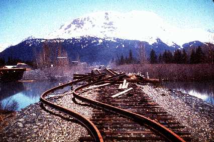 Photo from the Earth Science Photographs from the U.S. Geological Survey Library |
Typical damage to wooden bridges south of Portage. "The rails in this approach to a railroad bridge near the head of Turnagain Arm were torn from their ties and buckled laterally by channelward movement of the river banks during the earthquake. The bridge was also compressed and developed a hump from vertical buckling." [1] |
| "The rails were buckled by lateral movement of the embankment fill toward an underlying culvert, which had collapsed." [1] |
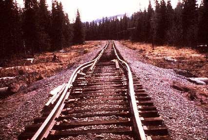 Photo from the Earth Science Photographs from the U.S. Geological Survey Library |
 |
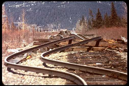
"The two steel rails showed the same evidence of land spreading. Sometimes they ballooned out, some turned in or they would both curve out, taking ties with them; other times leaving the ties frozen in place" [5] |
| "The earthquake shifted the steel trusses of the Copper River and Northwestern Railroad bridge near Round Island from 1 to 2 feet. This view shows one of the displaced trusses, which pounded against an adjacent steel girder span. The girder span was moved to the right, its concrete pedestal was rotated, and the girder span almost fell into the river. Note the shortening indicated by buckling of the guardrail." [1] |
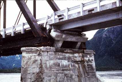 Photo from the Earth Science Photographs from the U.S. Geological Survey Library |
| "Under this compression, our wood bridges failed and took on appearances that were not within our design standards. One bridge jacknifed several feet into the air looking much like an A-frame cabin. Other longer trestles took on a long cambered arch appearance as the spreading soil pushed the ground up in the middle of river channels, thereby raising the middle of our bridges." [5] | 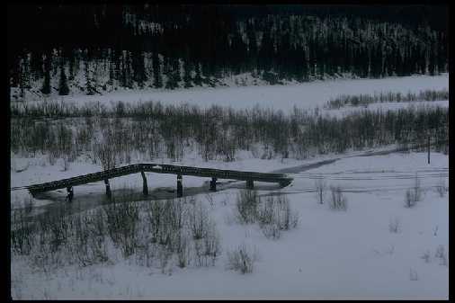
Steinbrugge Collection, Earthquake Engineering Research Center, University of California, Berkeley 4/4/64 |
Steinbrugge Collection, Earthquake Engineering Research Center, University of California, Berkeley |
Twisted rails! Notice ties still in place in frozen ballast. |
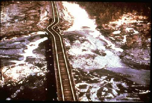
| When the ground level dropped, saltwater flooded low lying areas. The spruce forest quickly deteriorated and died leaving behind a ghost forest. | 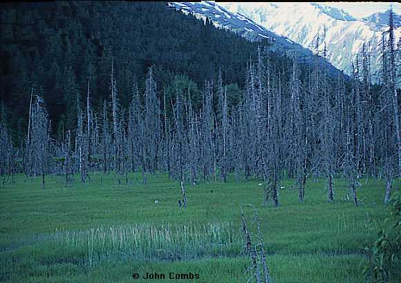
John Combs |
earthquake main | earthquake
story | information credits |
ARR
main page
The information on this page was last updated November 27, 1998