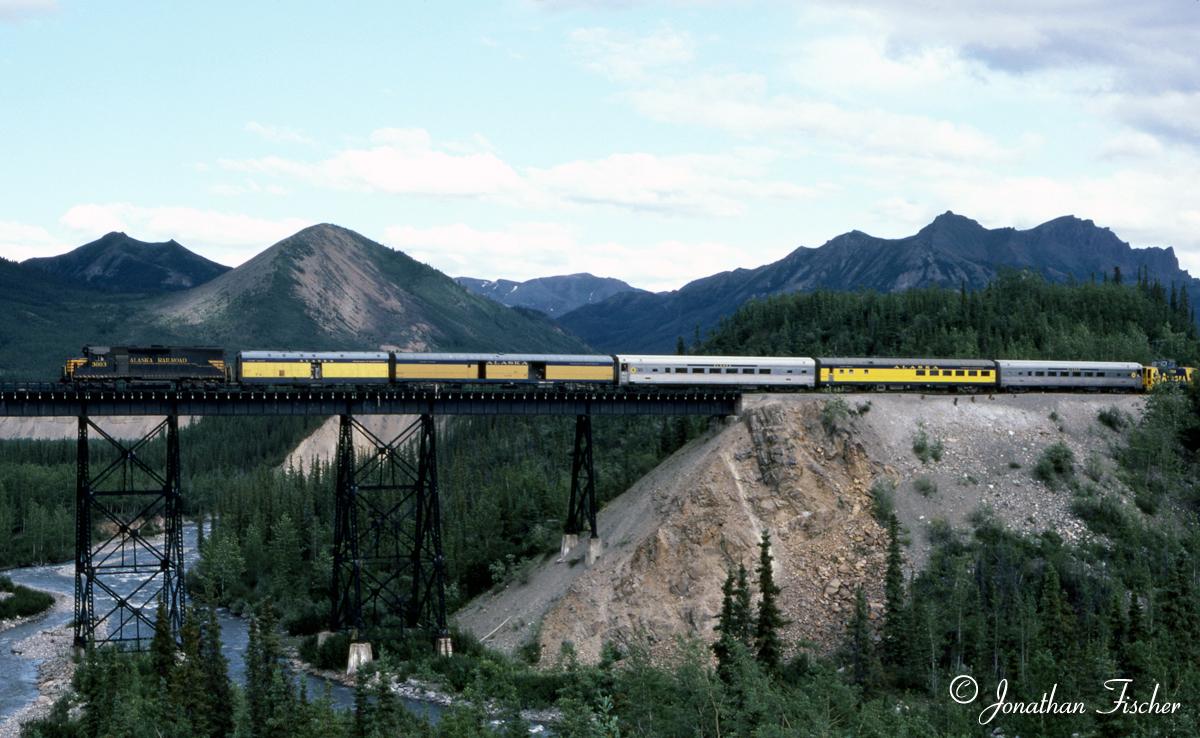
Location 1: This was my first trip up north having moved to Anchorage in the winter of 1981/1982. My father, in particular, was more excited about me moving to Alaska than I was. True to his word, he and Mom drove up the Alcan Highway, from their home in Bellingham in their conversion van. I was able to take a couple days off work and we went to the park and then to Fairbanks. To get to this spot walk down the easy, wide open Triple Lakes trail from the visitor's center. The bluff is to the right as you cross the bridge seen in Location 2. Note the train had a caboose, so this photo was probably on the weekend. You can see this mound in the background under the bridge from Location 5. 07/11/82
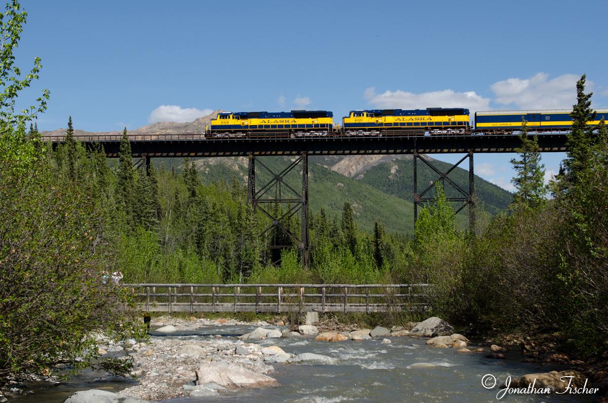
Location 2: This is beneath the steep dirt mound of Location 1 and on the north vs. south side of the stream. It's probably a 10-15 minute walk, down hill, from the visitor center to these spots. There are lots of people around during the day so there's not a big threat from wild animals. Note the tourists using their phones to take a picture of the train. The pedestrian bridge wasn't built when I took the picture in Location 1 in July 1982, so I would have had to have forded the stream to have reached that spot. I had more energy back then. 06/06/14
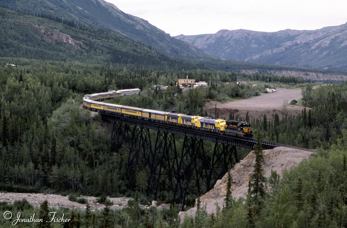
Location 3: It's interesting to note the growth in train size from 1982 to 1984. That year was when passenger traffic really started to take off. This hillside used to be wide open, but now it is increasingly overgrown with vegetation. While this shot is still possible, some discrete pruning at your chosen destination would really help. To get to this spot I walk through the woods next to the tracks to the bluff south of the bridge that we are all generally aware of. From there, continue heading west at about the same elevation and find an open spot to see the bridge. The sun is a bit nosy for the southbound Denali Star, so cloudy days have an advantage here. This is a brushy area and you are away from other people so you always need to pay attention, but the train is predictable, so you really only need to be here for a few minutes. Figure an additional ten minutes west of the bluff to get here. 08/10/84
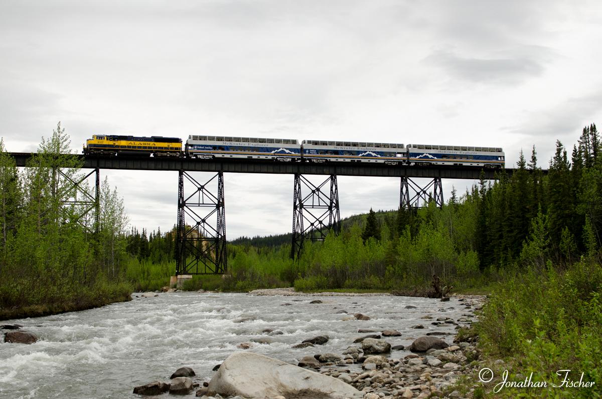
Location 4: One of my primary goals on this trip was to get this picture. My goal for next year is to improve upon it. First follow the Triple Lakes Trail over the bridge seen in Location 2. Continue on the trail until after crossing a nifty pedestrian only suspension bridge. Once across the bridge head east along the south bank of the river until you find the spot you want. Having already scouted this location last year, I pretty much knew where I was going when I set out to take this picture. But first I got a shot of the train going under the underpass at Healy and then drove straight to the park and walked fast right to the spot. I got to the spot 2 or 3 minutes before the train got there which surprised me. Had I had a couple minutes more I would have fine tuned this shot. A couple things to keep in mind. It's one thing to go down the Triple Lakes Trail, it is another thing to go back up the trail. I did that at least a half dozen times over the weekend. Depending on your "iron man" status figure anywhere from 5-15 minutes extra going up the hill vs. going down the hill. There are markedly less people in the park after 6PM. There are things, unexplained things, that go "bump" in the bushes that time of evening. So I was glad when I had this shot in the bag, had gotten up the hill and back to the car. From there the train has a big head start heading south, so you are making a choice when you go for this spot as it will be difficult to catch the train unless your travels take you in that direction at that time of night. 06/06/14
Location 5: Having a morning train is a great development. This is a shot from the eastside of the bridge which is in sun this time of day. Walk down the Triple Lakes Trail (just one more time) then head east under the tracks. From there the trail is useless, instead head to the north bank of Riley Creek and follow it east until you find the spot you want. There is another spot, you'll be standing at the top of a bluff, that can be accessed by parking under the railroad bridge on the Parks Highway and walking in as toward the bluff south of Riley Creek. Instead of heading west, head north to the bluff line. I've not gotten it, but I saw it while taking this picture and it appears doable. 06/08/14
Click here
for an aerial map of the locations.
My 2015 planning involves the opportunities created by the morning train.