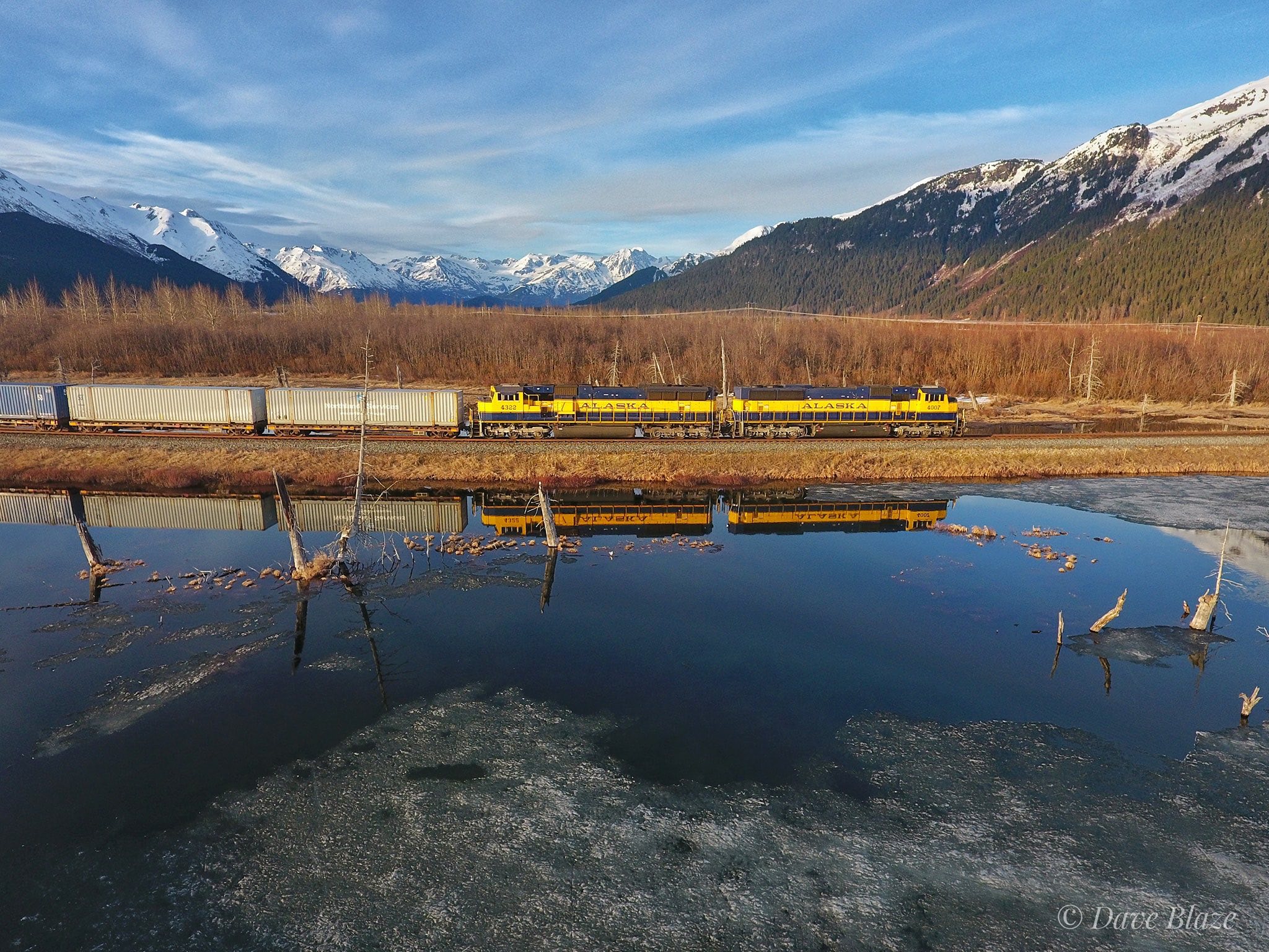
Portage Reflection I don't miss drone photography, but it sure was handy in Alaska for scenes like this. On a stunning spring evening in the Last Frontier a southbound 120S freight from Anchorage behind a pair of blue and gold SD70MACs has just taken the left turn off the mainline at MP 64.2 and is starting down the Whittier Branch main for the 12 mile run to its destination at tidewater on Prince William Sound and a date with the Alaska Marine Lines barge. After dropping it's train of COFC flats and outbound BNSF/UP interchange, the crew will turn right back for Alaska's largest city with northbound loads. In the distance at the head of the Twentymile River valley rise the high peaks of the Chugach Mountains which form a massive bulwark between Portage Valley and the waters of Prince William Sound. It's only 20 miles in a straight line to Harriman Fjord on the other side. The massive ice field feeds Twentymile glacier flowing west down this side and Harriman flowing east along with countless smaller unnamed rivers of ice. And in the foreground are some remains of the 'ghost forest' which is one of the last tangible links to that terrible day of March 27, 1964 when the second most powerful earthquake in documented human history devastated Alaska. The 9.2 magnitude quake destroyed Anchorage and the subsequent tsunami virtually wiped Seward and Valdez off the map. Here in Portage the ground (and the railroad with it) sunk 5 to 9 feet. While the small town of Portage was destroyed instantly the trees took longer to die. As they clung to the soil and sunk with the earth they remained upright and alive. But with their roots now below sea level they slowly sucked up the saline waters of Turnagain Arm which killed them and in the process 'pickled' them to prevent them from rotting so that nearly a half century later they remain as a link to that fateful day. Portage, Alaska |